
Collins
Libro: Collins Large World Wall Laminated Map (70 x 91.5 cm): Laminated map with flags, perfect for classroom, office and home
Libro: Collins Large World Wall Laminated Map (70 x 91.5 cm): Laminated map with flags, perfect for classroom, office and home
No se pudo cargar la disponibilidad de retiro
| Formato | Mapa |
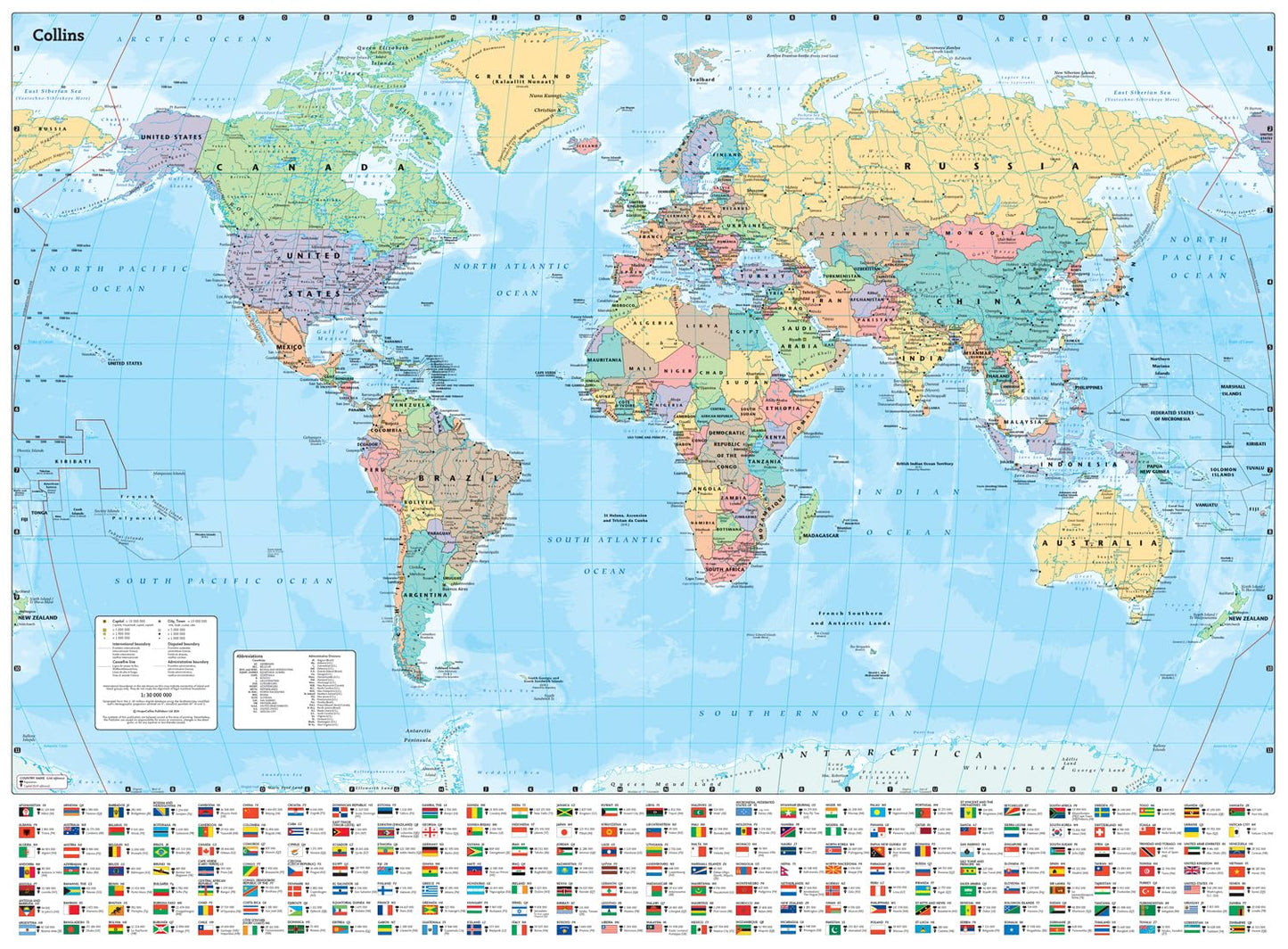
Explore the world with a Collins wall map
Fully updated world map to include the latest political changes. The map contains politically coloured mapping which shows each country and their capital city, major roads, and cities and towns clearly. Also included are national flags, key statistics for every country and inset maps of the polar regions.
The map is printed on high quality paper and comes rolled in a fully recyclable cardboard box – ideal as a poster for any classroom, bedroom or office wall.
Area of coverage:
All of the world, centred on the Greenwich Meridian, and including maps of the North and South Pole regions.
Scale:
1:30 000 000; 1 cm to 300 km; 1 inch to 480 miles
Size:
700 x 915 mm (27.5 x 36 inches)
Other versions available:
Paper flat map (ISBN 978-0-00-849255-7)
Share
Provetodo - provedor integral
🇨🇱 Chile: Duble Almeyda 5595, Of. 904, Ñuñoa, Santiago
🇵🇪 Perú: PEFRED S.A.C, Chancay 32, San Juan de Lurigancho, Lima 1542
+56991709189
© 2026 Provetodo. Todos los derechos reservados.